Carl Wark rises out of the boggy centre of Hathersage Moor like a mini volcano. There is a hint of the primeval about it, especially when partially shrouded by mists or hill cloud, as it often is. It is an evocative and mysterious place, that even now holds its secrets closely. Only a single, small scale excavation has been conducted there and that proved to be inconclusive.
It has long been classified as an Iron Age hillfort and sits in a landscape dotted with prehistoric remains, such as a round house near Toad’s Mouth, a ring cairn and possible standing stone on the slopes of Winyard’s Nick, along with both burial and clearance cairns, and Bronze Age field systems. One cairn appears to have been a burial and excarnation complex and a furnerary urn was found there during the 1950s (1).
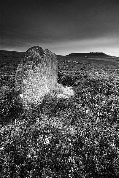
A small standing stone near Winyard’s Nick.
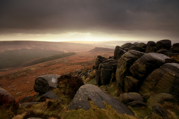
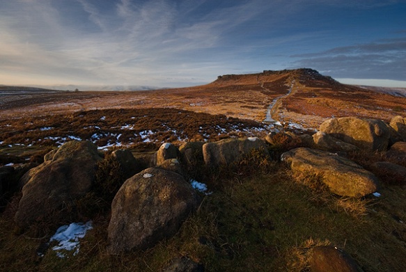
Carl Wark is a conspicuous landmark from every angle and would almost certainly have been used in some manner during the prehistoric period. It seems highly likely that nearby Higger Tor would have also been a significant landmark. Towering over Carl Wark, it seems unthinkable that there would not be some manner of relationship between the two.

View of Carl Wark from Higger Tor
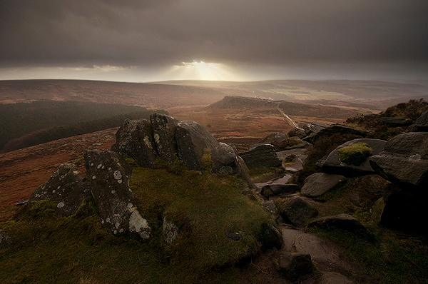
The flat-topped shape of Higger Tor is echoed in the shape of the largest stone in Wet Withens Stone Circe, on the northern edge of Eyam Moor, where the cairns and stone circe face towards Hathersage Moor, on the Summer Solstice sunrise/Winter Solstice sunset alignment. It is also worth noting that from the western end of Carl Wark, the midwinter sun sets over the pinnacle of Over Owler Tor, across Hathersage Moor to the south west. It seems highly likely that Carl Wark had its place in a ritual landscape, surrounded by significant landscape features.

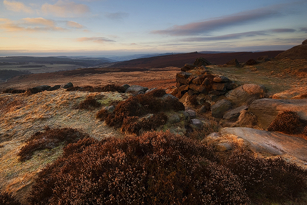
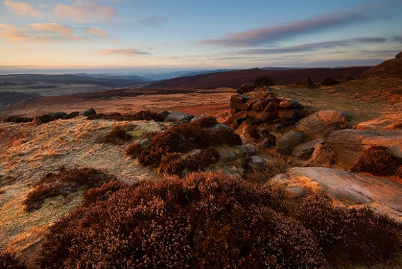
Midwinter sunset over Over Owler Tor from Carl Wark
To the south west of both Higger Tor and Carl Wark is the massive gritstone boulder, known as Mother Cap. Visible for miles around, it has been suggested that this was used as a marker for the nearby stone circles and cairn complexes and possibly illuminated at night by fire.

Mother Cap
The northern, southern and eastern sides are defended by sheer rock faces, although the southern side is lined by a single course of undressed stone. It is the western facing side, where the land descends down a gentle slope, along which the great wall was built. What remains is about three meters high and about forty meters long, with the possibility that it may have once been higher and topped by a wooden palisade. The entrance at the northern end of the wall is modern and probably the result of the footsteps of decades worth of visitors.
The south facing entrance at the southern end of the wall is particularly interesting, as it is narrow enough to allow entry to the interior only in single file and then, due to a blocking boulder, anyone entering is guided to turn to their right. Meaning that with the majority of people bearing their shields on their left arm, their less defended right flank would be exposed.
The entrance at the southern end of the wall

The entrance at the southern end of the wall

The entrance at the southern end of the wall
It is often asked if Carl Wark is a fort, why wouldn’t the much loftier Higger Tor make a better site to place it? Higger Tor may well be higher and look steeper from the south, but once past the southern brow of the hill, the land extends into a plateaux which then gently slopes to the north towards Stanage Edge. This would mean a much larger area would need to be defended. Although Higger Tor overlooks Carl Wark, there is enough distance between the two to put the fort out of range of arrows that could be fired in its direction.

The interior of Carl Wark, looking towards Higger Tor, from near Caer’s Chair
Once inside, the interior of Carl Wark is unlike any other hillfort that I can think of. Compared to Mam Tor for example, the interior of Mam Tor contains a number of hut foundations. This is common among hillforts in that they defended some form of living quarters, be they permanent or temporary. No such space exists within Carl Wark for similar structures, being tightly packed with boulders. The best known boulder being the rock named Caer’s Chair, which overhangs the rock face on the northern edge of the site and was described by Major Hayman Rooke, following his visit in the mid eighteenth century as, “a seat of justice, where the principle Druid sat… this place must have been intended for holy uses, or as a court of justice”(2).
During a survey of Carl Wark in 1948 Stuart Piggott noted that the wall and earthen bank was very similar to structures dating from the Dark Ages at forts in Scotland. When FG Simpson dug trenches into the earth bank behind the wall during his excavation in 1950, little dating evidence was found. However, the turf sod construction led to placing a date of 5th or 6th century as its likely origin (3)
View along the wall on Carl Wark
The name Carl Wark seems to have a number of possible derivations. It is probable that the current name has come down to us from ‘Carl’s Work’, or ‘Charles’ Work’ according to Hayman. Karl being the old Germanic/Nordic version of Charles. It has also been suggested that Carl and Charles are old names for the god Odin, meaning ‘Old Man’ (4) and for the devil also. To the all conquering Christians of the Dark Ages or early Medieval period, Odin was probably cast as the Devil in order to dissuade pagan practises. Meaning that it is the place, work or fort of Odin and variously, the Devil (5).
Another explanation could also be that its modern name is derived from its possible Saxon name ‘Caelswark’, the fort of the Caels (Celts). Caer can also mean a fortified place in Celtic tongues (6).
The enigma of Carl Wark is that the possibilities for interpretation of its history are numerous. My personal view is that it is a multi-period site, that was adapted for different uses over long periods of time. We know that the area around Carl Wark saw human activity throughout prehistory, particularly during the Bronze Age, when the area to the south was cleared for use as farmland and the associated building of living areas and funerary enclosures took place. It seems highly unlikely that places so conspicuous as Higger Tor, Over Owler Tor and Carl Wark would not have been significant to some degree to the inhabitants of the time. Especially taking into account views of seasonal events, such as sunrises and sunsets in context of the surrounding landscape. Caer’s Chair could well be significant in this respect, along with the other odd rock forms that litter the higher places of the moor.

Summer view of Higger Tor and Carl Wark, from Over Owler Tor
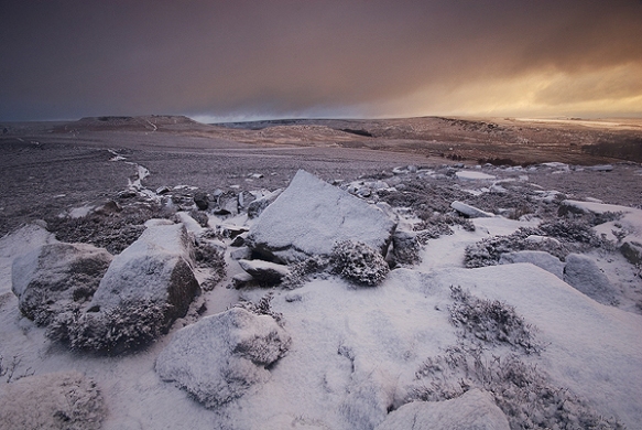
Winter view of Higger Tor and Carl Wark, from Over Owler Tor
The nature of the wall and entrance strongly suggest a defensive purpose. It has been suggested that the wall could have been built to block the view of Mam Tor from the interior, as some kind of snub. Personally, I think that such a function could have been achieved much more easily with a wooden palisade, rather than going to the trouble of building a turf and stone wall. In my mind, there is little question that the wall and entrance was built with defence as its primary purpose.
When compared to other walls that have been dated to the prehistoric period, such as those nearby at Gardom’s Edge, which are thought to date from the late Neolithic or early Bronze Age, the method of construction is very different, being largely constructed of a rubble core. In my opinion, the wall at Carl Wark is not of the prehistoric period, but as Piggott suggests dates from the Dark Ages. It was not uncommon during this period for ancient places to be reused and refortified.
As outlined in my previous post, Britain divided into independent kingdoms following the withdrawal of the rule of Rome. Boarder squabbles were common amongst these kingdoms but it was the aggressive expansion of the Northumbrian Angles of Bernicia and Deira, during the 7th century that caused much stress, especially in the region of the Southern Pennines. Piggott’s estimated date for the construction of the wall at Carl Wark was 5th or 6th century, or possibly later. Within margins of error, this places the fortification of Carl Wark bang in this period of history.
Within easy walking distance of Carl Wark are Win Hill and Loose Hill, in Hope Valley. Local folklore says that they gained their names when opposing armies of Mercians and Northumbrians camped on their slopes prior to going into battle in 626AD.
In 626AD, Prince Cwichelm of the West Saxons (Wessex) sent an assassin to kill Edwin of Deira. The attempt was unsuccessful and resulted in Edwin marching south to take his revenge on the Saxons. Prince Cwichelm and his father, King Cynegils of Wessex marched north to meet him (possibly with King Penda of Mercia). It is reputed that they met in Hope Valley.
The army of Wessex and the Mercians was much larger than that of the Northumbrians and it seems that the battle began to go against them. According to legend, the Angles had built a wall on Win Hill on which they were camped, behind which they withdrew. The Saxons, sensing victory charged forward but were crushed when the Northumbrians rolled boulders down the hillside on to them.
As there is no known documentary evidence to support that this battle took place, it could all be pure speculation and folklore. Also, no archaeological remains of the wall on Win Hill have ever been found. However, it is not uncommon for folklore to be transplanted from one place to another and there is one place nearby where a wall, most probably dating from the right period definitely exists. At Carl Wark.
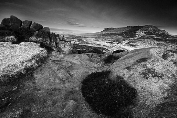
Higger Tor dominates the skyline, from the wall on Carl Wark
Could it be that the battle didn’t take place at Win Hill but on Hathersage Moor? The interior of Carl Wark is strewn with boulders that could certainly be levered off of the edges onto the enemy and there is a strong possibility that its name could link it with builders of Germanic origin. I must point out that there is no hard evidence to support this, it is a highly subjective personal theory that stands to be corrected. But it is tantalising non-the-less to think that what little evidence there is, points to the wall being built in association to the expansion of the Northumbrian Angles and that Hathersage Moor could well have played host to a bloody Dark Ages battle.
(1) Sheffield’s Golden Frame: Bill Bevan (2007)
(2) The Mystery of Carl Wark: (Mick Savage (1999)
(3) Antiquity Publications Limited Antiquity 25 (1951)
(4) The Hall of Waltheof: Sidney Addy (1893)
(5) Addy also suggests that Higger Tor was named after the Norse word for fear, ‘yggr’. Personally, I’ve always thought of ‘Higger’ as being a corruption of ‘Higher’, due to its obvious higher aspect when seen from Carl Wark.
(6) The Mystery of Carl Wark: (Mick Savage (1999)