Loxley Common: Legend & Murder

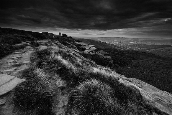
Sunrise on Loxley Common

Sunrise on Loxley Common

The village of Loxley sits on the very edge of the Peak District National Park, to the west of Sheffield and now almost swallowed by urban sprawl.

Loxley Common lies between the villages of Wadsley, Worrall and Loxley, near Hillsborough. Today a popular spot for dog walkers, there are few clues now left to it’s somewhat dark and grisley past.

Roman artifacts have been found on the common and it is said that Mary Queen of Scots used to ride here, during the period that she was imprisoned at Sheffield Castle. The common was used to graze animals and collect wood for centuries and from the mid 19th century, ganister was mined here, for use in lining the furnaces of the local iron and steel works (1). Interestingly, recent discoveries have been made that could push use of the common back into prehistory.

The common is also home to the sword in the stone, a rock that bears the lightly incised carving of what looks like a broadsword. Little is known of the origin or date of this, but it will be interesting to hear of any future advances on this or the possible prehistoric remains.

Robin Hood’s supposed birthplace on a hillock at Little Haggas Croft (Loxley Firth), lies close to Loxley Common. It is near here where outlaws were said to wait for travellers between York and Peveril Castle (owned by the Sheriff of Nottingham), on their way to the hunting grounds of the Royal Forest of the Peak.

First mentioned in the Sloan Manuscript, dating from around the end of the 16th century, it is said that he was born around 1160. A survey by John Harrison in 1637 describes the Haggas Croft site as, “‘the foundacion (sic) of an house or cottage where Robin Hood was born’ (2). The ‘Gest of Robyn Hode’ (originally possibly dating from around the early 1400’s) certainly places Robin Hood in Yorkshire.

As well as the Robin Hood legend, the common is also the scene of other stories, including murder and gibbetting.

In c.1740, Thomas Halliday built the supposedly fire resistant Cave House on Loxley Common, over the entrance to a cave. The house was occupied by the local game keeper.

It was the evening of 30th December 1812 when Mary Revill was murdered in Cave House, stood lonely on Loxley Common. Her husband Lomas Revill, a game keeper, hadn’t come home that night. He had been seen in the local inn and was found the next morning in the gamekeeper’s cabin. deep in the woods. The night has seen a storm cover the common in deep snow and footprints leading from the cottage seemed to enter a cave on the brown of the ridge and disappear.

As time passed, Lomas Revill is said to have become a strange man and prematurely aged. As another New Year’s Eve approached, someone at the local inn remarked that the gamekeeper hadn’t been seen for a few days. A party of men went up to the cottage on the common and there in an outbuilding, found his body hanging from a rafter. The spectre of a white lady is said the haunt the area still.

Loxley Common, close to Cave House

Loxley Common, close to Cave House

Frank Fearn is a name that will be for ever associated with Loxley Common, for it was here where his gibbetted body hung in chains.

Frank Fearn was hung in 1782 (probably in York) for the murder of local watchmaker Nathan Andrews. He lured Andrews with a story of a pocket watch club (where customers would save weekly towards the cost of a pocket watch) at the Old Horns Inn at High Bradfield. En route to the Old Horns Inn, Fearn clubbed and stabbed Andrews to death on Kirk Edge Road and hid his body in a nearby copse.

Following his execution, his body was returned to Sheffield and gibbetted on Loxley Common, close to the scene of his crime. There it hung until Christmas Day 1797, when Frank’s bones finally fell from their chains. The land on which the gibbet stood, was purchased by Thomas Halliday, owner of the Robin Hood Inn as a tourist attraction. The land was later bought by John Payne, who’s descendants donated the land (Loxley and Wadsley Common) to the people of Sheffield in 1913.

In 1792 the body of Highway Man Spence Broughton was gibbetted at Attercliffe in Sheffield. His accomplice, John Oxley escaped from prison and hid out on Loxley Common. When spotted on the common, he committed suicide rather than face the same fate as Fearn and Broughton.

(1)  Wadsley & Loxley Commoners: http://www.wadsley-loxley.org/history.html

(2)  Quoted in Addy, A Glossary of Words Used in the Neighbourhood of Sheffield, p. lxxiii.

A Trip Along Stanage Edge

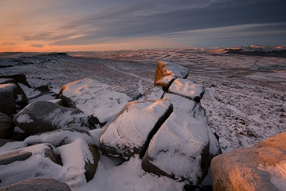
A winter sunrise at Stanage Edge southern trig point

A winter sunrise at Stanage Edge southern trig point

A summer evening on Stanage Edge

A summer evening on Stanage Edge

At approximately four miles long, Stanage Edge is one of the Peak District’s best known and impressive locations. A walk along Stanage Edge is a journey through not only through the geology and natural history of the area but 4000 years of human history and influence.

The southern section of the edge is by far the most popular, with a several nearby car parks and easy access. It is used for a multitude of recreational activities and during a walk along the edge, you will no doubt encounter climbers, joggers, cyclists, ramblers, families and occasionally paragliders. As well as photographers! It is not a place to visit if you are looking for solitude.

The northern end, between Stanage End and High Neb, is much quieter. It can be accessed via a small parking spot on the A57 near the turning for the Strines. Or from Dennis Knoll car park at the starting point of the Long Causeway. You are far more likely to find yourself alone here. Near the A57 parking spot, a drystone wall marks the boarder between Yorkshire and Derbyshire.

Starting from the southern end and traveling north, there are numerous spots of interest along the edge. Parking at the roadside lay by above Overstones Farm allows the easiest access, with just a short walk to the southern terminus of the edge (parking is also available at Upper Burbage Bridge, Hook’s Car and Stanage Plantation Dennis Knoll).

Before you reach the edge itself, a short scramble up to a well known group of millstones is a worthy diversion. These lie just below the part of the edge where the trig point stands. Millstone production took place along the Eastern Edges from medieval times, through to the first half of the 20th century. These particular millstones are thought to date from the early nineteen hundreds and were probably pulping stones. They were abandoned where they were made due to a collapse in demand. They have now become one of the iconic Peak District views and a reminder of the area’s industrial past.

Light breaks over Win Hill and Hope Valley following rain

Light breaks over Win Hill and Hope Valley following rain

The view north along the edge to Stanage Plantation and High Neb

The view north along the edge to Stanage Plantation and High Neb

A short climb from here brings you onto the top of the edge. Just a few feet away is the trig point (457m/1499 ft), from which wonderful views in all directions can be had, particularly following Derwent Valley with views of Win Hill and Kinder Plateau to the north and down towards Chatsworth House in the south. Also west along Hope Valley to the cement works at Castleton, the Great Ridge and Mam Tor beyond. Generally, Stanage Edge, being west facing, is best photographed in the late afternoon or evening, when the light catches the escarpments. However, this end of the edge affords views south and to the east, making it a good spot for sunrises too.

A medieval packhorse route stretches north to south along the edge and paved sections can still be found. Follow this northward, with a splendid, expansive view of the edge stretching up towards Crow Chin ahead of you. Eventually, you come to a small cave and ledge in the upper part of the escarpment known as Robin Hood’s Cave, which the outlaw was said to use as a hideaway. This area has very strong connections with the legend of Robin Hood, with his reputed birthplace of Loxley only eight miles to the north, just to the west of Sheffield. The reputed grave of Little John lies nearby in St Michael’s Churchyard in Hathersage. The cave is now partially collapsed, apparently with someone inside it when the collapse happened. According to a local story, he was only found three years later when the rubble was cleared.

The area between the cave and Stanage Plantation offers some good opportunities for photography, with it’s dramatic walls of rock and long views towards Crow Chin. This area is particularly popular with climbers and care should be taken not to trip over or dislodge their ropes fixed amongst the rocks on top of the edge.

In 1845 Charlotte Brontë visited her friend Ellen Nussey, whose brother was the vicar of Hathersage and stayed at the vicarage for three weeks. During this time, she took the opportunity to explore Hathersage and its surrounding moorlands. It is well known that she used Hathersage as the setting for her novel Jane Eyre and that Thornfield Hall is based on North Lees Hall, an Elizabethan Manor House occupied by the Eyre family and visible from Stanage Edge.

It is unsurprising that Stanage Edge was chosen as a location for the 2005 film adaption of Pride and Prejudice. The rock on which Keira Knightley stands during the sweeping, panoramic scene on the edge can be found at the northern end of Stanage Plantation. You can view a clip here.

A summer sunset over the rock on which Keira Knightley stood during the famous scene in Pride and Prejudice


A summer sunset over the rock on which Keira Knightley stood during the famous scene in Pride and Prejudice

A late summer evening stroll on the edge

A late summer evening stroll on the edge

A little further on and you will arrive at the track known as the Long Causeway, which starts at Dennis Knoll, crosses the edge and continues to Stanedge Pole and Redmires beyond. It has been speculated that the causeway is a section of the yet undiscovered Roman road from Navio fort in Hope Valley, to Templeborough. It seems however that the causeway is more likely to be a much more recent packhorse route than a Roman road.

From the causeway, it is a short stretch to High Neb and Stanage Edge’s second trig point (458m/1502 ft). This is a great place to capture views of the edge stretching to the south and another batch of millstones that lay below the edge. At Crow Chin are two bronze age cairns and from here, the edge turns northeast.

High Neb looking south

High Neb looking south

Stretching west, away from the edge you will see Bamford Moor below you. Hidden amongst the heather here are more bronze age cairns, including a ring cairn. Further north, after Jarvis Clough, lays Moscar Moor and Hordron Edge which includes one of the Peak’s best stone circles at the Seven Stones of Hordron.

One of the hundred or so numbered grouse troughs

One of the hundred or so numbered grouse troughs

One of the unique features of the northern section of Stanage Edge are the numbered grouse troughs carved into the rocks. These were carved about 100 years ago to catch rainwater. At this time, Stanage Edge was a privately owned grouse moor and it is thanks to the persistence of those ramblers and climbers of the first half of the 20th century that the first National Park was created in the Peak District in 1951, so that we can now all enjoy this beautiful area.

A little further along the edge, set back slightly in the heather is a ruined hut, most probably a game keeper’s shelter or possibly associated with the quarry. Finally you arrive at Stanage End to find old quarries and boundary markers, this is the northern-most tip of Stanage Edge.

Of course, you don’t need to attempt to shoot the whole of Stanage Edge in a single go. The images that accompany this text have been shot over the course of a number of years. Often it is best to choose a small section and get a few good compositions, rather than running around like a loony during the few minutes when the light is at its best. You can always go back again another time and cover a different section.

A spring sunset near Crow Chin, looking over Moscar Moor

A spring sunset near Crow Chin, looking over Moscar Moor

A Spring sunrise overlooking Moscar Moor and Derwent Edge

A Spring sunrise overlooking Moscar Moor and Derwent Edge

A Winter sunrise on Stanage Edge

A Winter sunrise on Stanage Edge


Blackstone Edge

The Aiggin Stone

The Aiggin Stone

The Aiggin Stone

This upright stone is thought to be a medieval waymarker, sited on an old packhorse route, overlaying a Roman road crossing the Pennines. A rude latin cross is incised on the stone, with the letters I.T. Possibly used as a stopping point to say prayers for a safe journey over the moors (being a much more dangerous undertaking thatn it is today), or sometimes as a resting place for those carrying coffins, where prayers for the dead would be recited (1). It is also possibly a boundary marker, being so close to the Yorkshire/Lancashire boarder.

The stone once stood several feet tall but has been diminished by falling and being pushed over. It was found laying in the heather in 1930 and was set back up again in 1933. It has been suggested that the name is a corruption of the Latin word ‘Agger’, meaning “a pile, heap, mound, dike, mole, pier – in Roman antiquity, an earthwork or other artificial mound or rampart.” (2)

An alternative suggestion is, ““The name ‘Aiggin’ suggests a pronunciation resembling either ‘edge’ or ‘hedge’ and thus it might mean ‘Edge Stone’. Alternatively it could be derived from the French ‘aguille’, meaning a needle or sharp-pointing rock.” (3)


The weather worn boulder Robin Hood's Bed

The weather worn boulder Robin Hood’s Bed

Robin Hood’s Bed

At the highest point on these lonely, windswept moors, sits a weather worn boulder known as Robin Hood’s Bed. The top of the boulder is hollowed out in a large depression. Legend has it that Robin Hood once slept here, while his followers stood guard.

There is a possibility that the Robin Hood legend here could have displaced a much older legend, that the site was the resting place of an ancient leader. In old Welsh, the word bedd means ‘grave or tomb’ (4). The etymology of the nearby village of Walsden means ‘Valley of the Welsh’ (5). Anglo-Saxon settlers called the indigenous Britons, ‘Welsh’, meaning foreigner. So it is possible that the name derives from the old British site of an ancient tomb.

Another oddity is that when I reached here, after climbing from the car park near the M62, I saw a line of people dressed in what appeared to be white robes walking away on the footpath that leads to the car park near Blackstone Edge Reservoir!


Blackstone Edge

Blackstone Edge

Blackstone Edge Chartist Meeting

But waved the wind on Blackstone Height
A standard of the broad sunlight
And sung that morn with trumpet might
A sounding song of liberty!

It is hard to believe now that this high moorland outcrop played a part in the battle for our civil rights. Yet on Saturday 1st August 1846, 30,000 people from the surrounding mill towns and villages gathered here at a Chartist’s rally, to hear Manchester radical Ernest Jones speak.

The days of radical uprisings, the outlawing of trade unions, the hangings and deportations of the Luddites and the Peterloo Massacre in Manchester, were still within living memory. The Chartists were the first mass working class labour movement, calling for political reform in Britain, they would often hold their meetings in remote places to avoid the attentions of the mill owners and police. They took their name from the Peoples Charter, first published in May 1838 calling for, amongst other demands, universal suffrage.

“When the State calls for defenders, when it calls for money, no consideration of poverty or ignorance can be pleaded, in refusal or delay of the call. Required, as we are universally, to support and obey the laws, nature and reason entitle us to demand that in the making of the laws, the universal voice shall be implicitly listened to. We perform the duties of freemen; we must have the privileges of freemen. Therefore, we demand universal suffrage. The suffrage, to be exempt from the corruption of the wealthy and the violence of the powerful, must be secret.”

Between 1838 and 1851, five petitions were put to parliament. The second in 1842 containing over three million signatures. All were voted down by MPs (leading to the Yorkshire and Lancashire Plug Riots). Although Chartism itself failed to achieve it’s aims, it did seriously unnerve the political elites and opened to door to winning gradual political reform throughout the remainder of the nineteenth and into the twentieth century.

Though hunger stamped each forehead spare
And eyes were dim with factory glare
Loud swelled the nation’s battle prayer
Of – death to class monopoly!


(1)  Ray Spencer – The Northern Antiquarian http://megalithix.wordpress.com

(2)  Herbert Collins (1950) – The Northern Antiquarian http://megalithix.wordpress.com

(3)  James Maxium (1965) – The Northern Antiquarian http://megalithix.wordpress.com

(4)  Paul Bennett – The Northern Antiquarian http://megalithix.wordpress.com

(5)  Kai Roberts – The Northern Antiquarian http://megalithix.wordpress.com