Smoke from a grass fire lingers over Yeoman Hey, Saddleworth Moor.
Someone once said that there is no such thing as bad weather, just inappropriate clothing. But despite being dressed in the latest Gortex mountain gear, many photographers will pack away their equipment and head for home when the light doesn’t show. However, grey skies, hill cloud and conditions that are considered less than ideal, can still make for atmospheric photography.
Ask any landscape photographer what gets them out of bed and off into the hills, at all manner of un-godly hours and the reply will always be the same. To catch the light! That beautiful, fleeting light that only sunrise or sunset can throw across the rocks, turning them into hot coals and lighting up the sky in glorious pinks and oranges. When everything comes together, those mornings are a true joy.
More often than not however, an early start can be met by less than perfect conditions. Those photos of perfect mornings with raking light, dramatic skies, frosty rocks and misty valleys are hard won. They are the work of stubborn persistence, going back time and time again until you are rewarded by rare conditions of light and atmospherics.
Although it is obviously always good when the elements combine to present you with those valued shots, I am a great believer that all is not lost, when the conditions don’t play ball. Quite often, some of my favourite shots have come out of the worst of conditions.
Hill cloud, cloud-bound horizons or over-zealous mists can conspire to block out the light, right at the vital moment. It just means that sometimes you need to be adaptable and work a little harder, with the conditions that you are given.
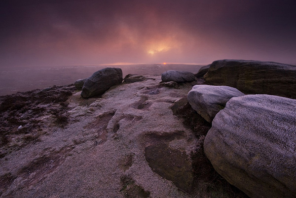
Low cloud almost obscures sunrise on Higger Tor.

The sun finally breaks through at Higger Tor.
One of the best morning’s work that I ever produced came from a morning when at first, all seemed very unpromising. I arrived at Higger Tor one frosty January morning to find low cloud skimming the hill top. It seemed that another early rise had been in vain! I took the path to the top of the tor, set up and managed to capture a couple of shots of the sun sneaking between the horizon and the cloud base. Both were fine shots but I thought that would be my lot.
One lesson that I have learned, is to stick with it. If you get nothing, at least it is nice to be out! After another twenty minutes, the sun rose just enough to clear the cloud on the horizon and punched through the low level hill cloud, lighting up the frosty rocks with golden light. It was one of those jaw-dropping moments that stays with you for a lifetime.
Of course, it doesn’t always work out quite so well. But there is still plenty of promise during those times when the sun doesn’t struggle through. Grey skies, hill cloud and mist can have their own beauty. The textures offered by glowering skies and soft, diffused light can still introduce drama into photography and are ideal conditions to shoot for black and white.
Mono is a much over looked aspect of landscape photography and can be just as pleasing as an image saturated in colour.

Light punches through overcast skies at Derwent Edge, near the Wheel Stones.

Beams of light illuminate the hills around Derwent Valley, from Curbar Edge.

Light over Alderman Hill, from Hollin Brown Knoll, Saddleworth Moor.
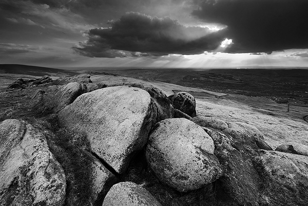
On those cloudy days, it is worth a try at shooting during the middle of the day. All of those landscape photography rules-of-thumb advise against this, but it is often when the sun is higher that it stands a better chance of punching through the cloud, producing dramatic rays of distant light.

Low cloud skims the hill tops of William Clough, Kinder Scout.

Low cloud blocks out the long distance views from Upper Burbage Brook.
Low cloud can have a beauty of its own, even though it may well block out the views as well as the light. The trick is to find a foreground that can add interest in its own right. In the image above, the worn old stones at the crossing point of Burbage Brook and sweep of the middle distance draw the eye into the centre of the image. That you can only just make out the shape of the hill beyond, through the hill cloud adds atmosphere to the image. Those moments of perfect light are fleeting and our wild, upland places are more often to be found in cloud and rain. I think it is important to celebrate all of the moods that my beloved Pennines have to offer and the dark rocks coupled with the moody sky at William Clough on Kinder Scout (above), achieve that mood perfectly at this iconic location. It was here that the legendary Kinder Scout Trespass took place.

A layer of hill cloud lingers around Curbar Edge.
In the image above, a layer of cloud plays around the quarries of Curbar Edge. The cloud was thin enough to allow through the sunrise colours in the clouds above, but thick enough to block out the sun. However, what this image may lack in light, I think it makes up for in atmosphere. I remember that the morning was very still and cold, with a feeling akin to being underwater.

Mist rolling over Hathersage Moor, from Higger Tor.

Hill cloud rolls in from Wessenden Head, from the slopes of West Nab.

The windswept grasses on the summit of West Nab, Meltham Moor.

A cold winter wind whips the grasses of Buckstones, on Marsden Moor.
Another great way to add interest to images is with texture and movement. The wind-whipped grasses of the Pennines are particularly characteristic and a feature of the hill tops of the Meltham, Marsden and Saddleworth areas. I find the sweep of the grasses not only a useful device in the composition of the image, sweeping the eye into the frame, but something that is evocative of these wild places, drenched in history and folklore.

The Aiggin Stone at Blackstone Edge, near Rochdale.
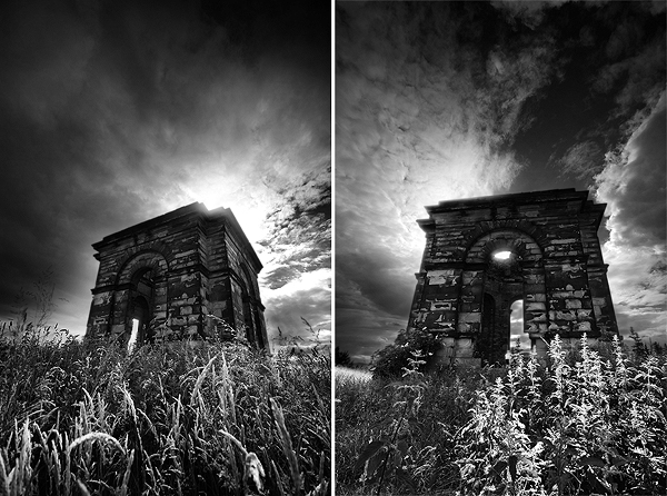
Black Dick’s Temple, near Kirkheaton, Huddersfield.

St John’s Church, Oulton near Leeds.
Places of historical or architectural interest often work well when framed against moody skies. Such as the spire of a church as above, or a place that is the subject of historical tales. A dark, moody background can be far more evocative of these legends, than a perfectly light scene ever can. The Aiggin Stone above, is a Medieval way-marker on the old packhorse route (which overlies a Roman Road) over the moors above Rochdale. It was a stopping point for travellers to say prayers for a safe passage on their journey. I think that the foreboding nature of the sky compliments the history of the place.
Black Dick’s Temple (see my earlier piece on this blog for more) is swathed in tales of dark doings, death and deception. A jolly sunset would be a bit inappropriate!
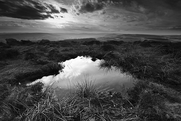
A small pool at Carhead Rocks.
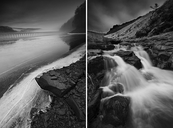
Ice and mist at Ladybower (left) and one of the waterfalls along Greenfield Brook, Saddleworth Moor.
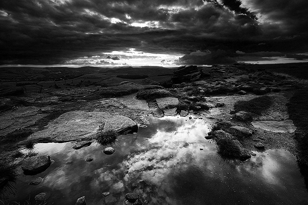
Puddles on Stanage Edge, reflecting the sky.
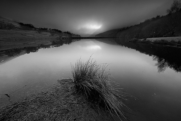
A slight chink in the murk, reflected in the still waters of Ladybower Reservoir.
If you can, when the light isn’t playing nicely, try to get near water. Water works particularly well, reflecting surrounding scenery and available light, or by adding movement and contrast.
In the images above, a small pool at Carhead Rocks reflects the dramatic skies above. Ice at Ladybower adds both texture and perspective to the image. A waterfall at Greenfield Brook on Saddleworth Moor brings movement and contrast to the dark rocks of Ravenstones Brow, framing the image from above. Even puddles are a great device to use to add interest.
The other shot of Ladybower was taken on a particularly murky morning. Stanage Edge was a white-out, so by dropping below the cloudbase and putting water into the frame, I was able to capture a slight chink in the clouds reflected in the still waters. The reeds provide good foreground interest too.

Snow clouds from Over Owler Tor, Hathersage Moor.
One November morning, while out on Over Owler Tor, I was caught in a fast moving snow storm. Of course, the moors look fantastic in snow anyway, but I particularly liked the image above as the contrast between the snow and the dark rocks make the image look almost mono, except the wedge of green to the left of the frame, of the fields below the snowline. I think it captures the foreboding mood of the darkening skies well.
Light streams through dark clouds over Uppermill, from Shaw Rocks on Saddleworth Moor.

An evening stroll on Stanage Edge, under dark skies.
So, I hope that I’ve managed to convince you that there is still much beauty to be found and plenty of great photographic opportunities, when the light doesn’t show. Don’t pack up your gear and head for breakfast. Stick with it and work a little harder to find subject matter that suits the conditions. You never know what will happen and unless you are there, you will not capture those great images when the opportunity presents itself. The bacon butties can always wait a little longer!

Pre-sunrise on Curbar Edge, Derbyshire.

Waiting for the light to break at Curbar Edge.